Home

-----------

Jewelry

-----------

About

Montana

Agate

-----------

Rock Hunting

Montana

-----------

About

Yellowstone

Jewelry

-----------

Banjos, etc.

-----------

Village of Baoma, Sierra Leone


NAVIGATION


HYDROGEOLOGIC SETTING

 The village of Baoma is situated in a valley near the southwest margin of the capital city of Freetown, Sierra Leone.  The valley floor is at an elevation of from 200 to 450 feet feet above mean sea level (AMSL) and the surrounding ridges rise to slightly above 1,000 feet AMSL.  Bedrock is diorite with localized lateritic weathering of bedrock.  Weathered diorite is slightly rounded and exfoliated.  The weathered, shallow laterite is tightly cemented and vesicles are filled with breakdown residuum.  The valley floor contains some large, isolated boulders of diorite colluvium.


Diorite           Laterite                       Large diorite boulder near Garden Spring

The PSU EWB Chapter visited Baoma in late December 2011 through early January 2012, which is approximately the middle of the dry season.  
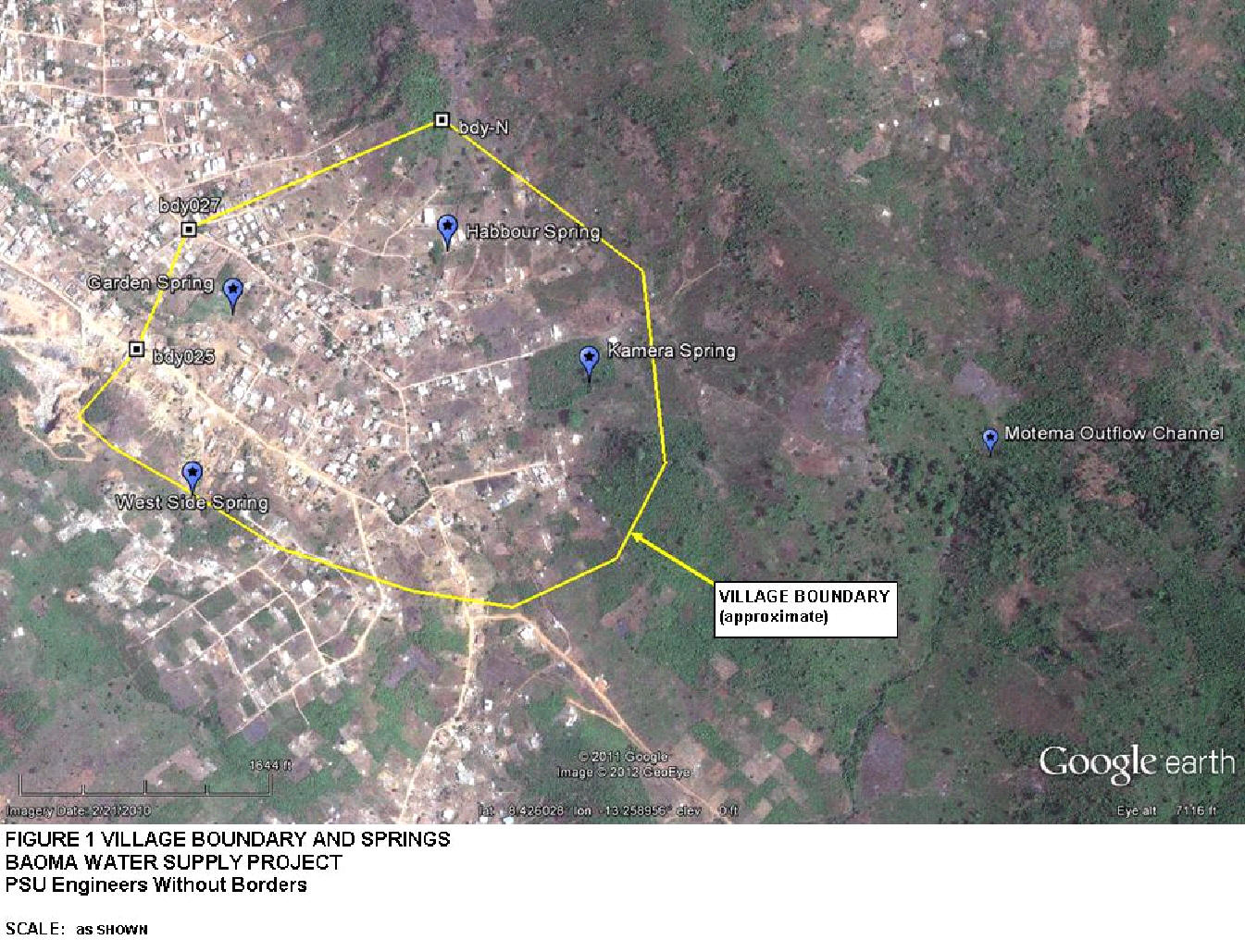
PSU EWB visited three local springs:  West Side, Habbour, Kamera, and Garden Spring.  PSU EWB also visited the outflow channel from the Motema Spring and several groundwater seeps in the former diorite quarry at the locations shown in Figure 1

Figure 1

Groundwater circulation occurs primarily through fractures and other secondary porosity features in bedrock.  
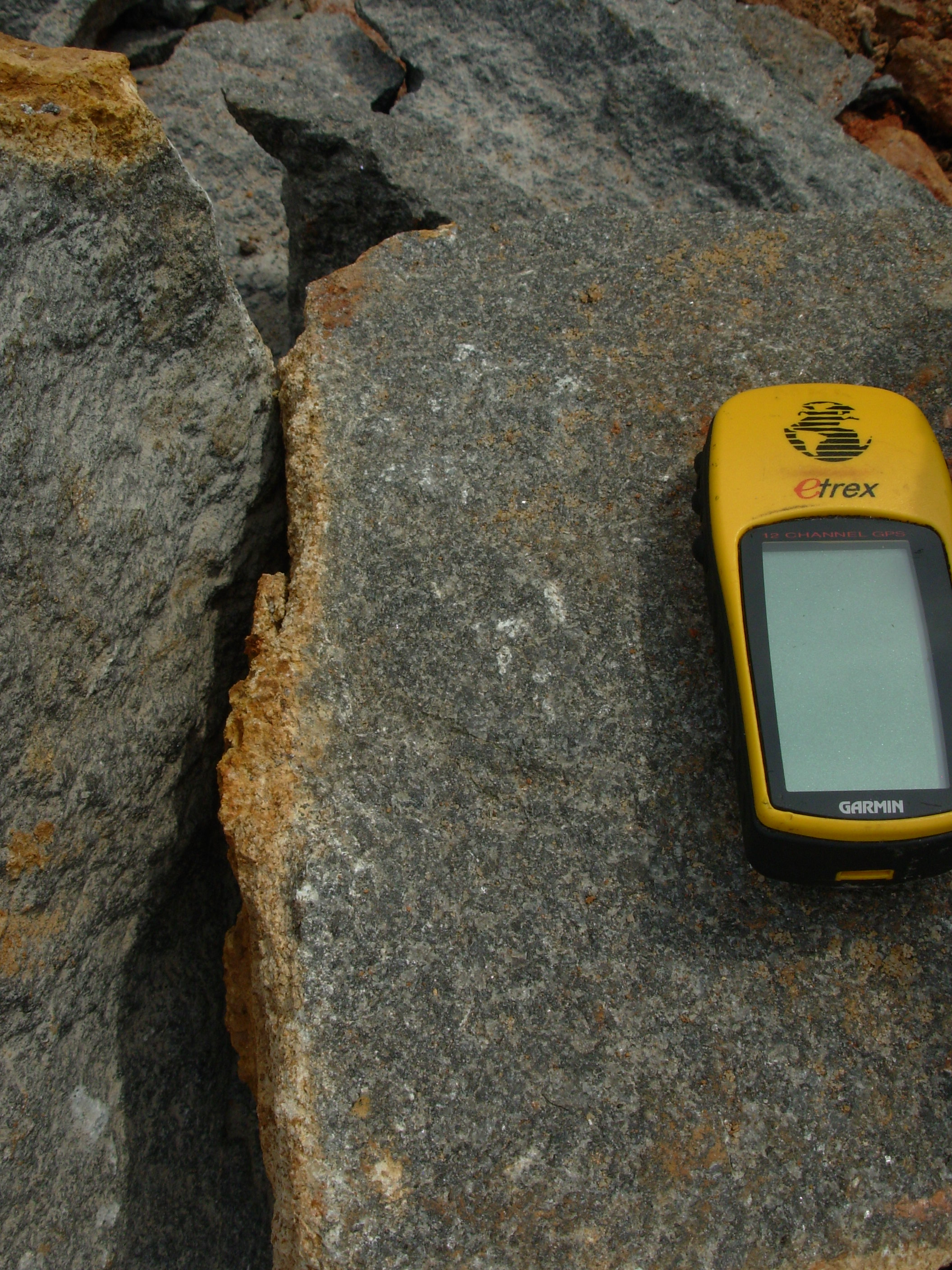
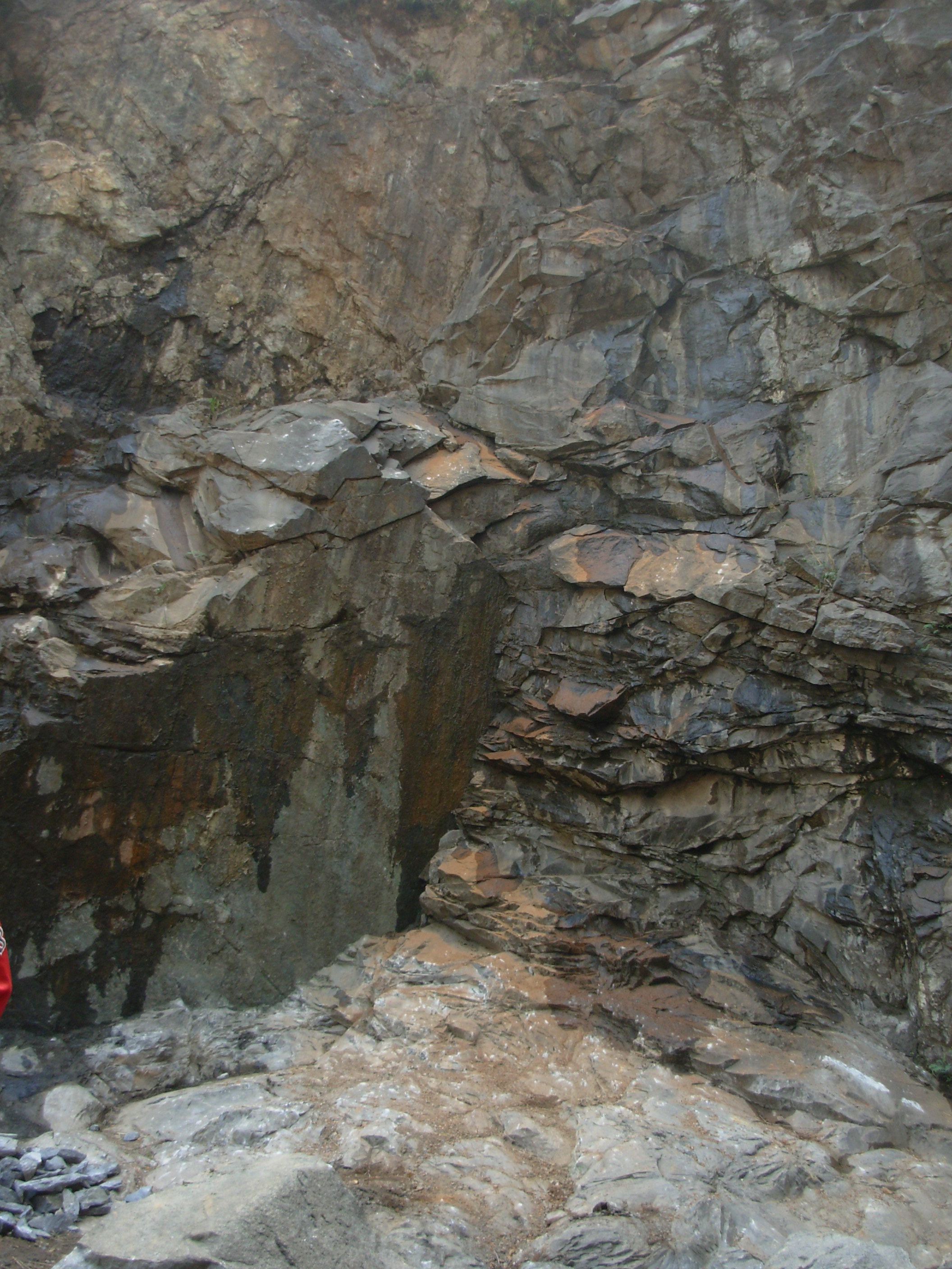
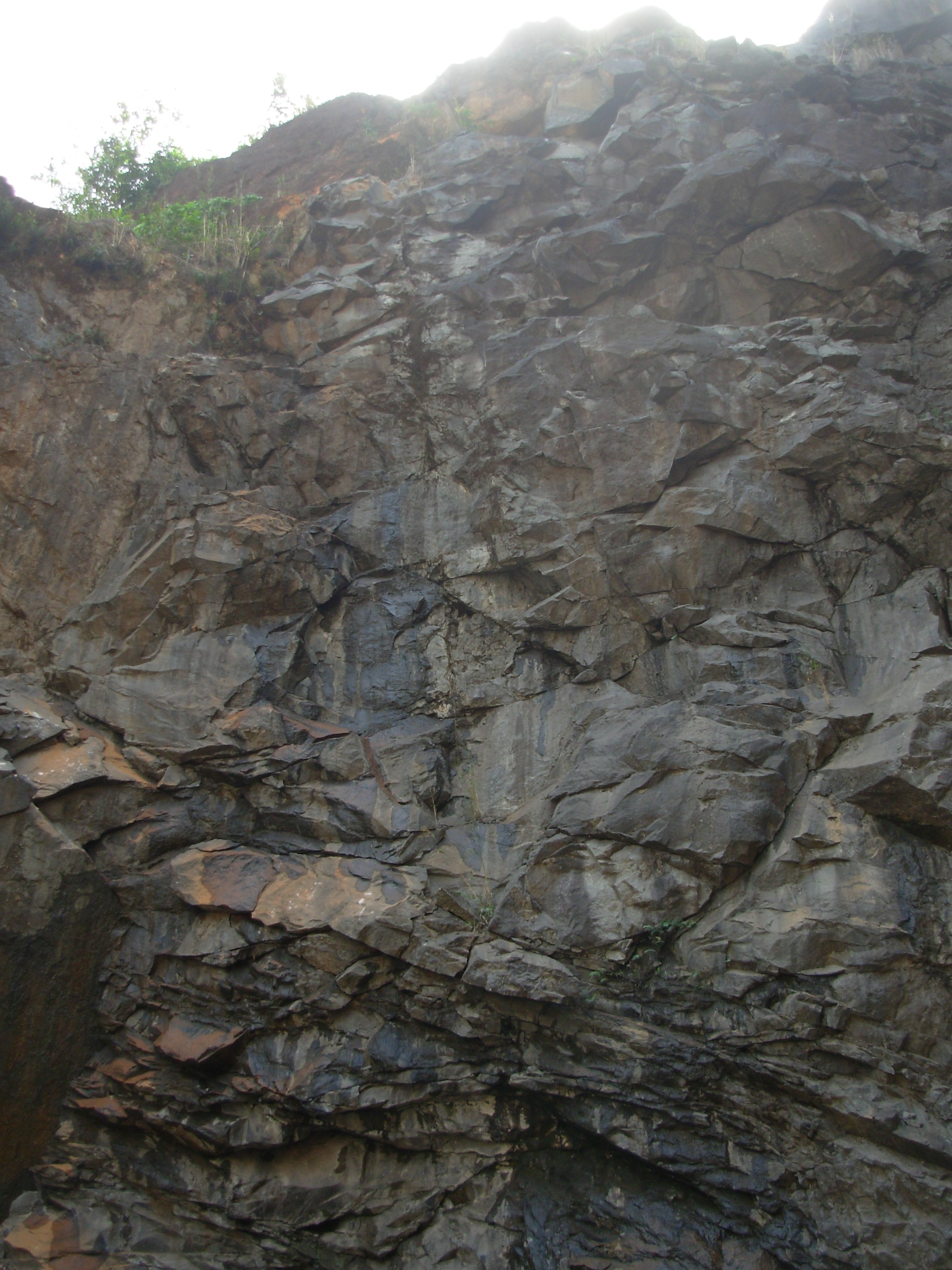
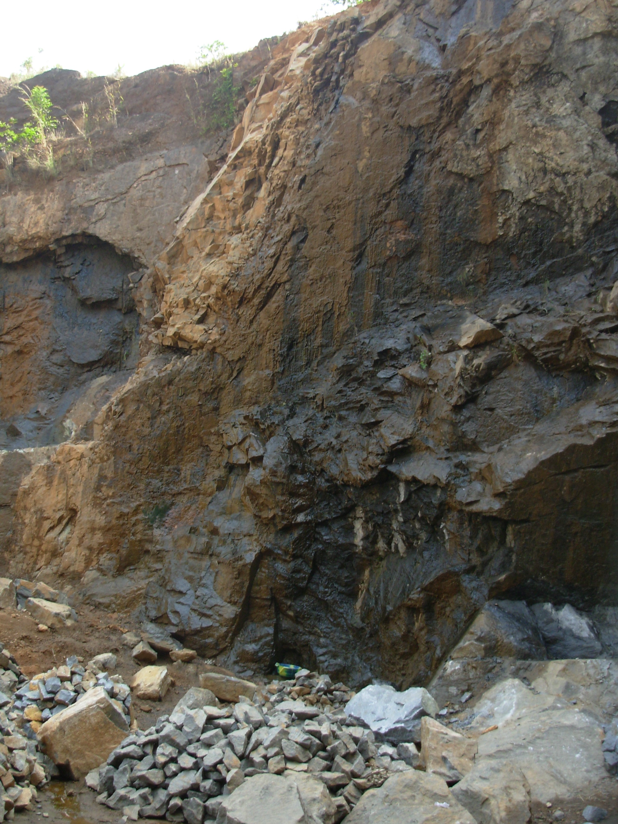
The diorite bedrock, as viewed in the former quarry located at the south end of the village, is generally massive (i.e., large, unbroken in-situ masses) with some regional jointing oriented approximately north-south and dipping approximately 30 degrees to the west.  Several narrow fracture zones of at least 200 feet in depth and less than 10 feet in width were seen in the quarry wall.  
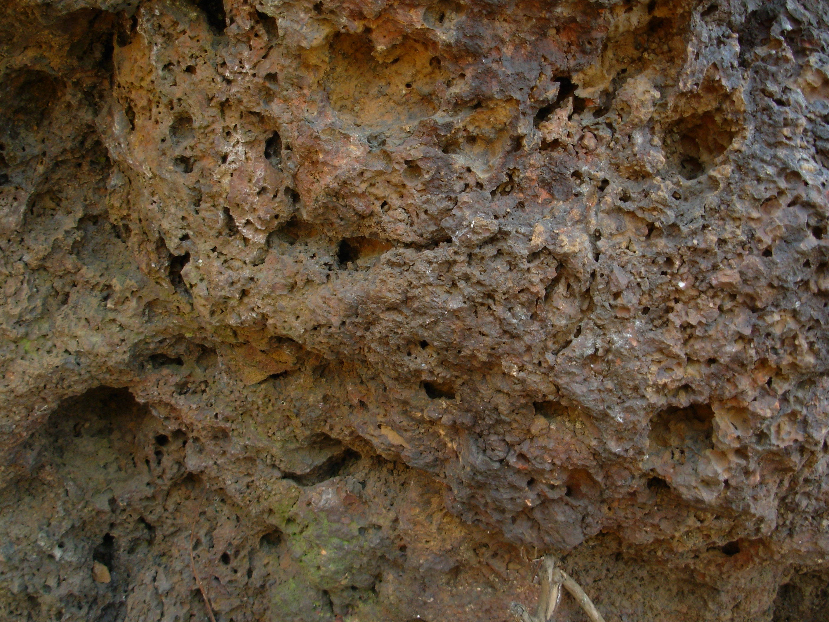
Some of the exposed fracture zones discharged small amounts of groundwater.


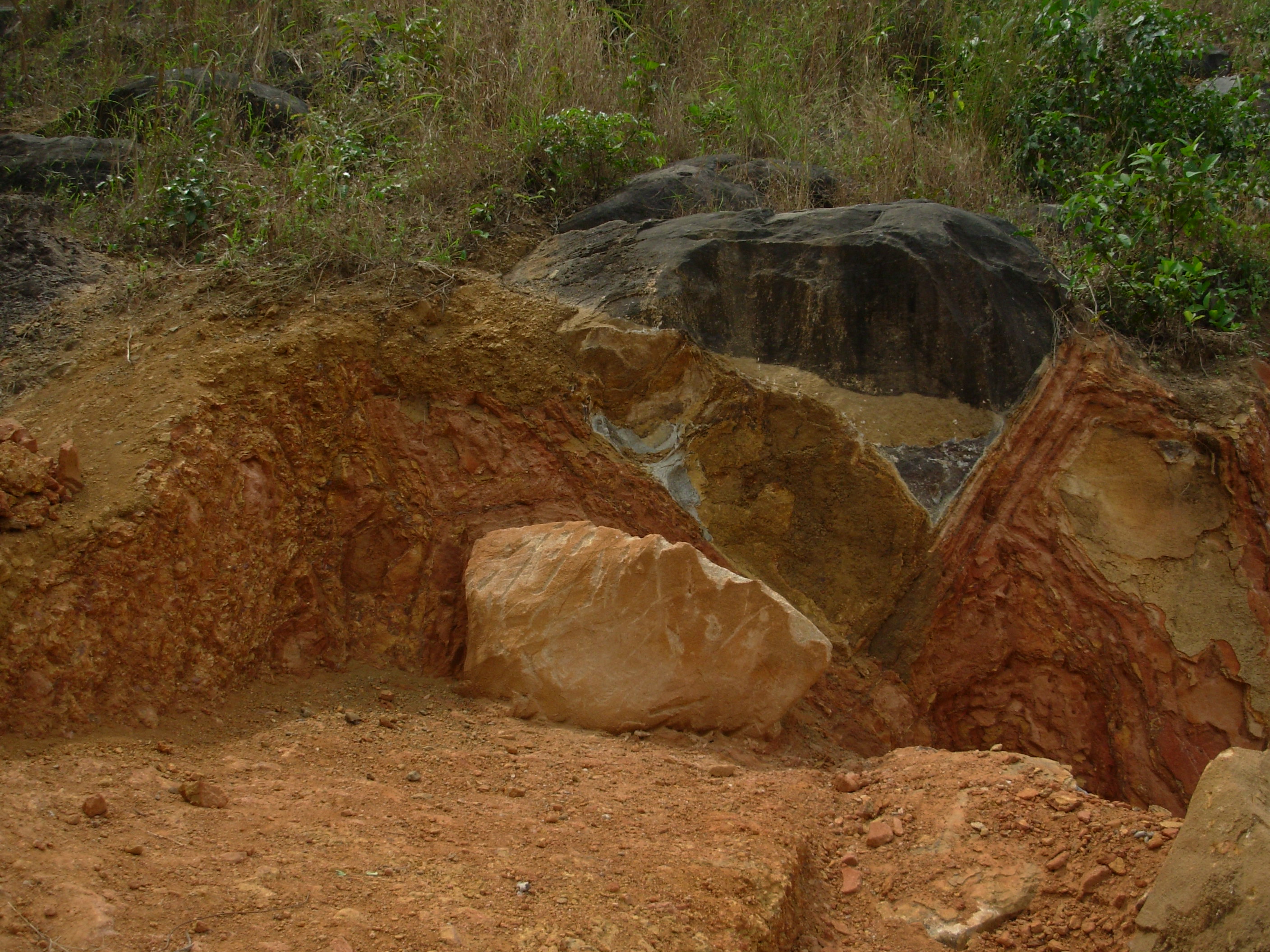
Deep seepage in       Shallow seepage in     Seepage at fracture zone

brecciated diorite    fractured/brecciated


                       diorite

 Some brecciated (broken rock) zones were noted in the quarry at a depth of approximately 200 feet below surface.  
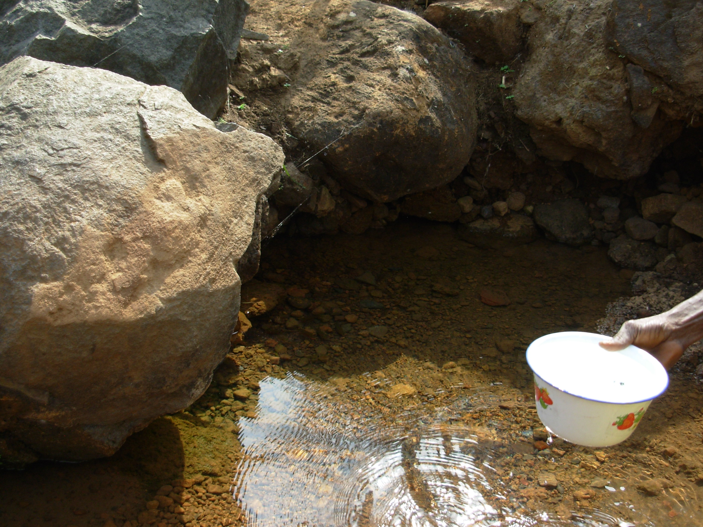
Based upon a) the occurrence of one prominent seep near the top of the quarry highwall and b) decreasing secondary porosity features with depth noted in bedrock, it appears likely that the groundwater that is being discharged at the valley wall springs (West Side, Habbour, and Kamera) is related to flow in shallow secondary porosity features within approximately 50 feet of the ground surface.  This shallow, weathered zone is interpreted to drain the deeper, slower-circulating, less fractured groundwater reservoir through open fractures and open joints.

The West Side, Kamera, and Habbour springs all issue from vents in diorite bedrock.  At the time of the PSU EWB visit, the flow rate of these bedrock springs was on the order of a few gallons per minute.  All of these springs are located near the inflection point in the valley walls between the angle of repose (approximately 20 degrees or more slope) and the colluvial deposit at the foot of the valley walls (less than approximately 20 degrees slope);  see Figure 1.  These springs reportedly continue to discharge well into the dry season.  The geomorphic position of these springs may be related to differential bedrock weathering and development of secondary bedrock porosity in the upland versus valley settings.  The low discharge rate and persistence of flow at these bedrock springs is apparently related to limited discharge rate through secondary porosity features and "damming" of the groundwater reservoir by poorly-transmissive bedrock.

The Garden Spring issues from the contact between overlying alluvium and underlying laterite/diorite, and was flowing at approximately 40 gpm during the PSE EWB visit.  The Garden Spring likely receives convergent groundwater flow from a number of fractures upslope along the valley walls.  Some flow persists at the Garden Spring throughout the dry season.

The spring vent of the Motema Spring was not visited.  The Motema outflow channel was flowing at approximately 100 gpm during the PSU EWB visit.

The chemistry of the water at the bedrock springs and the Motema outflow channel is very similar:  very low specific conductance (approximately 50 umhos/cm), low total dissolved solids (approximately 25 ppm by calculation), slightly acidic (pH approximately 6.5 units), and no measurable nitrate nitrogen.  This chemistry is consistent with the conceptual model of shallow groundwater circulation through diorite bedrock.  The water at the Garden Spring contains approximately 3 ppm NO3, likely due to the nearby upgradient latrines.  All springs contained some coliform bacteria, and no analyses for specific, pathogenic bacteria were performed.

The following water supply alternatives may be feasible in this setting:

  • improve sanitary quality of spring collection systems
  • develop point-of-use storage (e.g., small tanks) at the spring vents to capture night-time and off-peak use flows.
  • enhance source water protection near the existing spring vents
  • develop new, passive, low-yield, gravity spring vents using horizontal drive points at selected locations
  • develop a gravity-feed system from the Motema Spring
  • reduce water loss within the distribution system.

The following alternatives are likely non-feasible in this setting:

  • develop high-yield well(s) in valley flank or valley floor (bedrock generally not suitable)
  • develop sanitary groundwater withdrawal in or downslope from the village (due to latrines and livestock wastes)
  • develop impoundment or system storage sufficient to meet dry season needs from existing spring sources an/or wet season flows (economic considerations)


Back to Table of Contents

Next:   7.0  Water Supply Alternatives

Go to  9.0  Donations